The bay
Banderas Bay, sunsets and whales
The bay that the Rhythms of the Night boat crosses: its size, its name, its humpback whales, when skies are clearest and what the southern shore holds.
Book the sunset sail and show on Viator ↗Quick answer
Banderas Bay is a Pacific bay in Jalisco and Nayarit with about 100 kilometres of coastline, bounded by Punta Mita in the north and Cabo Corrientes in the south. Wikipedia calls it an important breeding and birthing ground for humpback whales, but whale sightings on the sunset sail are a seasonal possibility, not a promise.
The bay in brief
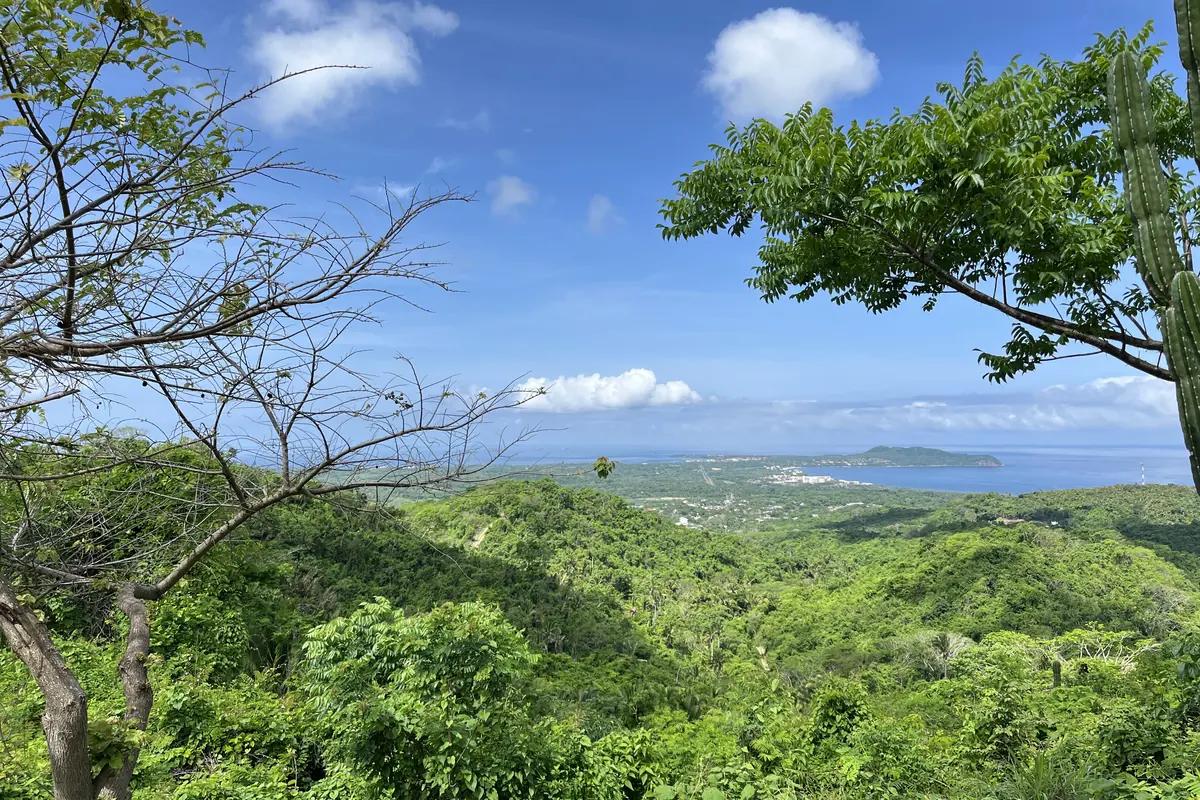
Wikipedia describes Bahía de Banderas as a bay on the Pacific coast of Mexico, shared by the states of Jalisco and Nayarit. It is bounded by Punta Mita to the north and Cabo Corrientes to the south, and its coastline runs for about 100 kilometres. Locals regard it as Mexico's largest bay, but Wikipedia says it is not. Puerto Vallarta has long been its main resort destination and cruise port.
How it got its name
Bahía de Banderas means Bay of Flags. Wikipedia's Puerto Vallarta article says the name is believed to come from a 1524 encounter between Spanish soldiers and local warriors, who it says were mesmerised by the flags the soldiers carried. It hedges the story with the words believed and according to reports, so treat it as tradition rather than settled history. The same article says the bay later became a major port and safe harbour for the Manila galleon trade.
Two states, one bay
The north of the bay is in Nayarit and the south is in Jalisco. Wikipedia says the Nayarit municipality of Bahía de Banderas follows the same Central Time Zone as Puerto Vallarta, so that visitors crossing the state line and flying out of the airport in Puerto Vallarta avoid confusion over time. For your evening, the practical point is that the bay's shoreline municipalities around Puerto Vallarta keep the same clock.
Humpback whales
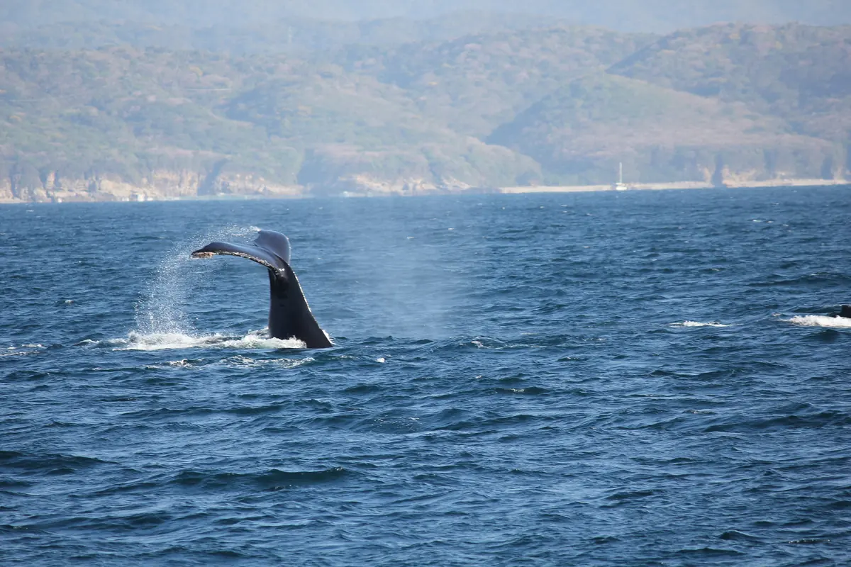
Wikipedia calls Banderas Bay an important breeding and birthing ground for the humpback whale. Its article on Boca de Tomatlán says whale-watching tours are offered from November to March, and the operator says whale sightings on its sunset cruise are possible from December through March. None of those sources promises a sighting on any given night. A sunset sail with a dinner show is not a whale-watching trip, so treat a whale as a bonus.
Sunsets from the water
The booking page describes the sail as a sunset trip, so your boat leaves in the light and arrives at dusk, with the departure time set by the season; the calendar and your confirmation give it for your date. Wikipedia says February, March and April have the least cloud cover in Puerto Vallarta, and that the rainy season runs from mid-June to mid-October. Clear skies are likelier in the dry months, but no source can promise your sunset.
The southern shore
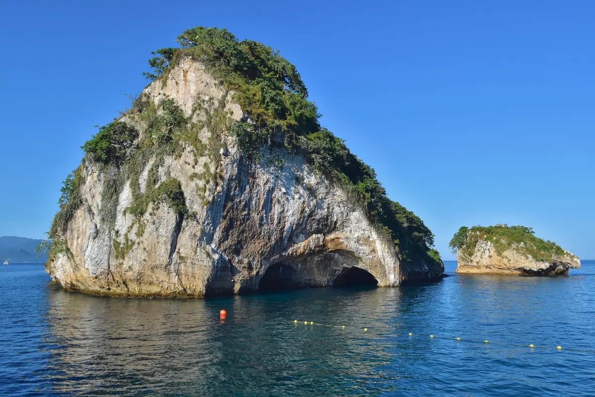
Wikipedia lists Colomitos, Las Ánimas, Las Caletas, Majahuitas, Mismaloya, Quimixto and Yelapa among the settlements near Boca de Tomatlán on the southern shore. Los Arcos National Marine Park lies offshore of Mismaloya, about 12 kilometres south of Puerto Vallarta, and has been protected since 1984, according to Wikipedia, which describes it as a breeding ground for sea birds. The Rhythms of the Night boat heads for this coast.
Who this isn't for
Whale-watchers who need a sighting should book a dedicated whale-watching trip in the November to March season rather than a dinner-show cruise. If you want a daytime look at the southern shore, look for a listing built around that. This guide is background reading, not a promise about your evening.
Read next: Is Rhythms of the Night worth it?
Frequently asked questions
How big is Banderas Bay?
Its coastline is about 100 kilometres long, between Punta Mita and Cabo Corrientes. Locals regard it as Mexico's largest bay, but Wikipedia says it is not.
What does Bahía de Banderas mean?
Bay of Flags. Wikipedia says the name is believed to come from a 1524 encounter in which warriors were struck by the flags the Spanish soldiers carried.
Will I see whales on the sunset sail?
Possibly in winter, but not for certain. The operator says whale sightings are possible from December through March and gives no guarantee.
When are the skies clearest?
Wikipedia says February, March and April have the least cloud cover in Puerto Vallarta. The rainy season runs from mid-June to mid-October.
Where do the boats go?
South across the bay to Las Caletas, a cove between Yelapa and Quimixto on the southern shore.
Sources